The Calculate Distance feature on the map enables you to calculate the distance between 2 points on the map and then get directions on how to travel between the 2 points.
For information on getting directions on the map, click here.
To calculate the distance between 2 points on the map:
-
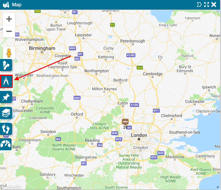
On the Map, click the Calculate Distance icon.
-
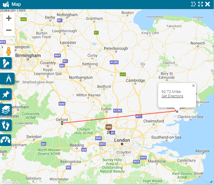
On the map, select the 2 points whose distance you want to measure.
Once you click the second point a line appears between the 2 points and the distance between the points displays in a pop-up.
-
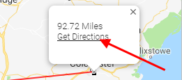
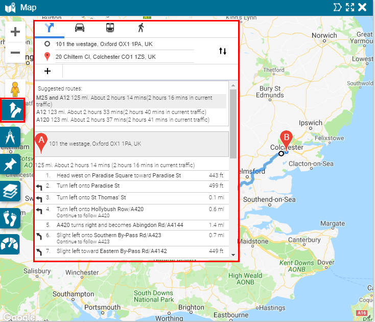
Click the Get Directions link to get driving directions between the 2 points.

The directions appear on the map.