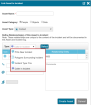
When linking an Asset to an incident there are typically two scenarios. Both are supported in the Link Asset to Incident Wizard:
- Creating a new Asset in the system that is linked to the Incident
- Linking an Asset that is already defined in the system to the incident.
To add an asset to the incident in the Asset Wizard
-
Click on the Plus icon (
 ), located at the top right corner of the asset list.
-
Type the Asset's name
-
if the asset already exists in the system, an auto-complete list will be displayed. Click the relevant asset, and its information will populate the fields below
-
if the asset does not exist - enter its name, choose its category (people/object/ data), enter other information below and then click Create Asset.
-
-
Pick one of the following link types that describe the relationship between the Asset and the incident:
-
Geofence/Polygon surrounding Incident - this link type will ask you to pick from a list of geofences surrounding the incident location. The geofence you pick will be added to the relationships of the Asset. Any future incident which is located in this geofence will display this Asset.
-
POI - this link type will ask you to pick from a list of POIs surrounding the incident location. The POI you pick will be added to the relationships of the Asset. Any future incident which is located near this POI will display this Asset.
-
Incident Type - this link type will link the Asset to the specific Incident Type of this incident. Any future incident of this type will display this Asset.
-
Caller - this link type will link the Asset to the specific incident without any implication on other incidents in the future.
-
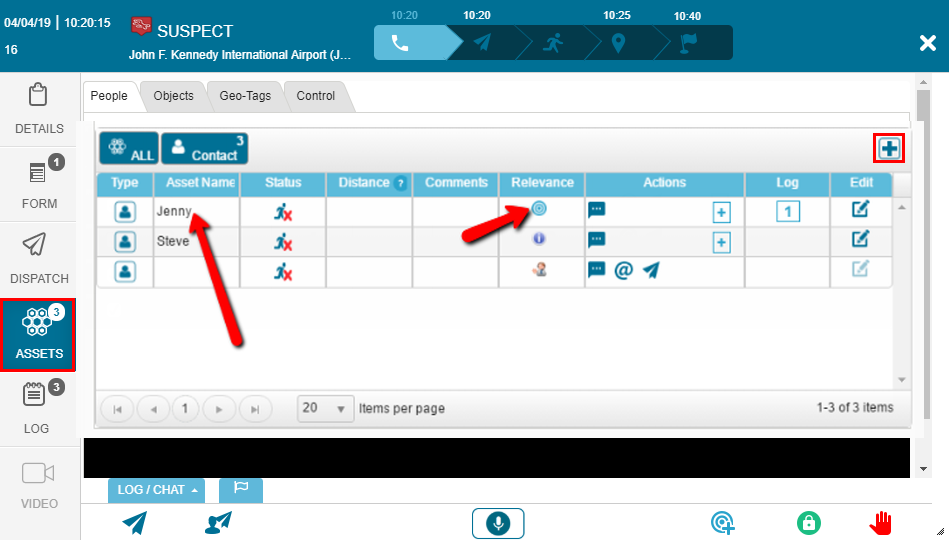

Geo-Tags
The dispatcher can also view and utilize the geographically tagged assets closely located to the incident by clicking on the 'Geo-Tag' tab, as seen below:
The type of information provided in the 'Geo-Tag' tabs include:
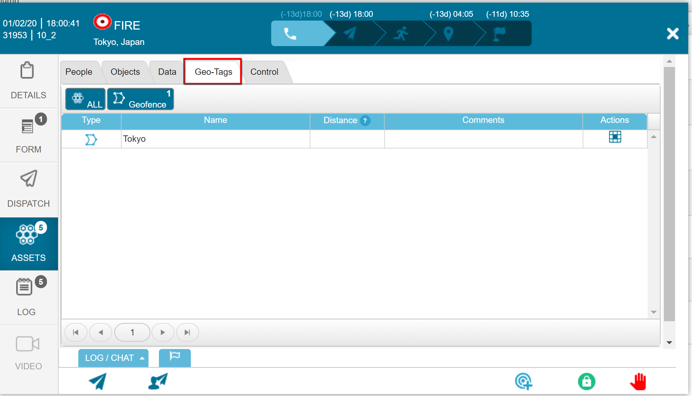
Type: POI / Geofence
Name
- Distance: The distance between the geo-tag and the incident
- Comments: Any comments associated with that geo-tag
- Actions: Actions that can be taken with the geo-tags, such as zooming the map into the geo-tag
The dispatch operator can center the map on the specific geo-tagged asset by clicking on the Zoom Map icon ( )
)
Users with the correct permissions can configure the maximum distance between an asset and an incident for it to appear in the list.